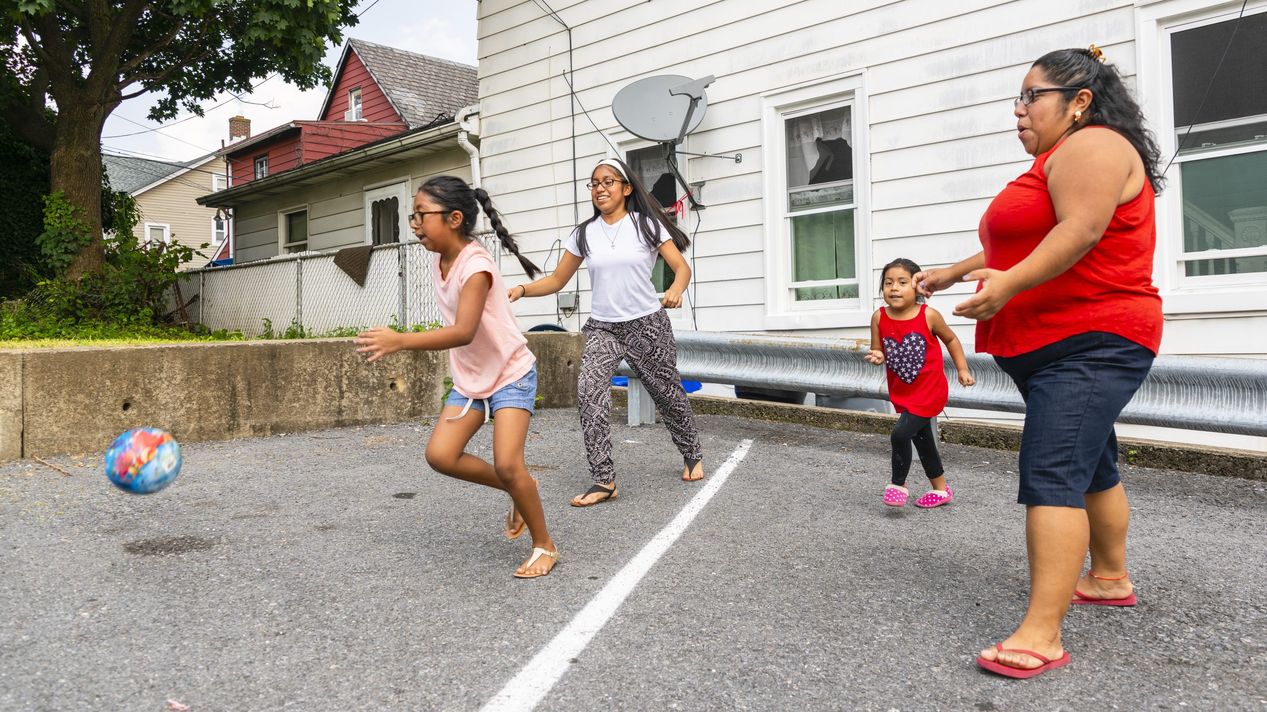
Icon: Physical Activity

Priority Strategy: Increasing Physical Activity Through Community Design

Implement policies and activities to connect pedestrian, bicycle, or transit transportation networks (called activity-friendly routes) to everyday destinations.

Background

Being physically active is one of the most important ways people of all ages and abilities can improve their health now and in the future. Yet only about 1 in 4 adults and 1 in 6 high school students fully meet the recommended levels in the Physical Activity Guidelines for Americans.

Access to safe places to play and walk, such as parks, safe streets, trails, and greenways, is important for physical activity. It is also important to be able to safely and easily walk, bike, or take transit to everyday destinations such as homes, workplaces, schools, parks, health care, and food outlets.

Additionally, many people from racial and ethnic minority groups and from rural areas are less likely to have access to these safe spaces. Historical land use and housing and transportation policies can contribute to limited access. People impacted by these disparities are also less likely to meet the physical activity recommendations.

Designing communities to provide access to these safe spaces for everyone helps increase physical activity and can provide better places to live. It can also help improve health equity.

To align with the Community Preventive Services Task Force’s built environment recommendation, increasing physical activity through community design needs to include at least one element from both of the following categories:

Activity-Friendly Routes to Everyday Destinations
Activity-Friendly Routes Everyday Destinations
These may include new or improved:
  • Street pattern design and connectivity such as convenient, connected, and accessible streets that create many route options, shorter block lengths, and shorter crossing distances.
  • Pedestrian infrastructure such as sidewalk networks that can include trails, traffic calming, intersection safety, street lighting, benches, public bathrooms, shade, and landscaping.
  • Bicycle infrastructure such as bicycle networks that can include slow/safe streets, protected bikeways, trails, traffic calming, intersection safety, street lighting, public bathrooms, shade, and landscaping.
  • Public transit infrastructure and access, such as transit networks that include expanded services, times, and locations; and public bathrooms that are safe and easy to access.
Plus symbol These may include increased:
  • Proximity to community or neighborhood destinations, such as homes, worksites, schools, parks, groceries, health-care facilities, pharmacies, and other shops.
  • Mixed land use such as neighborhoods that combine restaurants, offices, housing, or shops.
  • Residential density to increase the variety of housing options in an area through compact community design, and other approaches that reduce travel distances.
  • Parks and recreational facility access such as parks and recreational facilities close to homes.

* Designates short-term activities that may be accomplished in 1 to 2 years.

+ Designates activities that may take up to 5 years, depending on the organizations’ capacity, previous work in this area, and size of the project.

Potential Activities

State Activities

  • Create interdepartmental memoranda of understanding, interagency agreements, or staff-sharing agreements with key departments, such as the state’s transportation department as well as others represented in your cross-sectoral coalition. Meet to formalize the public health relationship and identify topics, projects, communication channels, and opportunities for collaboration.*
  • Provide technical assistance on community engagement and organizing, coalition building, needs assessment, action planning, evaluation, and how to identify additional resources related to increasing physical activity through community design.*
  • Provide or promote training to opinion leaders and state and local staff and coalition members on increasing physical activity through community design.*
  • Work with Metropolitan Planning Organizations (MPOs) or Rural Planning Organizations (RPOs) and state transportation departments to integrate health considerations into project scoring criteria so that projects with active transportation components get more weight. Consider focusing on high-need areas, such as places with limited networks of activity-friendly infrastructure, places at risk for pedestrian or bicyclist injuries or fatalities, and/or places with inequities. Help ensure connections with destinations.+
  •  Work with state transportation departments, MPOs, and RPOs to track and improve walking, bicycling, and transit conditions in places with population densities that support these activities and to increase residential density and mixed use.+
  • Work with partners to establish or update master plans; land use and zoning policies and plans; state pedestrian, bicycle, and parks and recreation plans; and housing, conservation, or economic development plans and to include equitable and inclusive access to physical activity as well as specific actions to carry out the plans.+
Father and daughter riding bikes together

State and Local Activities

  • Establish, expand, or participate in a cross-sectoral coalition including people affected by inequities in community design for physical activity and the public health, transportation, community planning, and parks and recreation sectors. The coalition may also include members who can help with specific issues such as housing, healthy food access, early care and education, K–12 schools, universities, public safety, and public works, among others.*
  • Work with partners to conduct health equity assessments.* These could include, among other elements, an analysis of:
    • Active transportation and public transit access, convenience, and reliability.
    • Concerns about and strategies to prevent gentrification/displacement.
    • Park, trail, and greenway access and safety.
  • Work with a cross-sector team to complete the Active Communities Tool to assess your community design and create an action plan to make it more activity-friendly.*
  • Identify relevant state, regional, and local data. Use data on health conditions, health behaviors, and local capacity to carry out policies and plans to increase physical activity through community design, prioritizing communities with health disparities. For example:
    • Collect health data such as physical activity levels, weight status, chronic diseases and risk behaviors, or pedestrian and bicycle injuries and deaths.
    • Note health equity assessment [PDF-1.1MB] findings, the number of champions or level of political consensus, existence of a cross-sectoral coalition or current action plan, experience with evaluation, or experience addressing health inequities.
    • Use mapping software when appropriate to identify areas where resources may best be focused.
  • Develop, tailor, and distribute culturally appropriate messages supporting active lifestyles. Messages should be developed and tested locally with intended audiences.*
  • Collaborate with partners to put into action new or improved plans and policies, activity-friendly districts, and/or other activities to create activity-friendly communities.+ Examples include:
    • Policies: Complete Streets,  Safe Routes, and Vision Zero policies including relevant city, school district, or parks and recreation department policies; policies to promote mixed land uses, transit-oriented development, and residential density.
    • Plans: Examples of land use and transportation plans that support activity-friendly communities include general or comprehensive land use plans that address physical activity; active transportation, trails, and greenways master plans; Complete Streets, Safe Routes for All, Vision Zero action plans; and incentives for activity-friendly project evaluation. Include specific actions to reach the goals and objectives.
    • Projects: Pop-up or demonstration projects with evaluation measurement, such as speed reduction, increased active travel, or use of new places; placemaking; adding bike racks, crosswalks, or traffic calming measures; or collaborating with partners to create new or improved sidewalks, protected bike lanes, and transit routes.
    • Codes: Zoning, building, subdivision, or other codes, including those that integrate land use regulations with other municipal goals, or regulate the form of buildings rather than land uses, such as Form-Based Codes and activity-friendly districts.
    • Programs: Safe Routes to School or Safe Routes to Parks.
    • Systems: Increase transit, bicycle, and pedestrian network connectivity and access, park coverage and accessibility, and incentives for activity-friendly project evaluation or supportive land development.
    • Community ideas and priorities: Innovative ideas and key priorities to design communities for physical activity that are community sourced and designed, demonstrating that residents are valued and appreciated.
  • Track the passage of plans and policies related to physical activity and document progress made to carry out the projects identified in these plans and policies.+

Local Activities

  • Conduct walk/move audits with local decision-makers and community members that represent diverse perspectives, such as age, ability, race/ethnicity, gender, sexual identity, income, and occupation.*
  • Conduct and evaluate inclusive demonstration projectswith the goal of permanent infrastructure changes that lead to policy, systems, and environmental changes, such as connecting active transportation networks and destinations. Measure the impact of the demonstration project on outcomes, such as speed reduction, increased active transportation, or use of new places.*
  • Assess access to parks, trails, greenways, and recreational facilities and work with community coalitions to create or improve safe access to these locations.*
  • Assess concerns related to increasing physical activity through community design by engaging community organizations and experts who can address these concerns.*
  • Provide training or technical assistance to coalition members and opinion leaders on activity-friendly routes to everyday destinations.*
  • Work with partners to establish or update comprehensive plans. Examples include plans covering regional and local areas, land use and zoning, pedestrian, bicycle, parks and recreation, housing, conservation or economic development plans and ensure they prioritize equitable and inclusive access to physical activity as well as specific actions.+
  • Work with partners to update zoning codes to include activity friendly design. Examples include form-based codes and activity friendly districts.+
Cross Cutting Areas

Resources

Active Communities Tool
Helps committed, cross-sector teams create an action plan to improve community environments that promote physical activity and meet the needs of their community.

A Guide to Building Healthy Streets: How Public Health Can Help Implement Complete Streets
Community guide that focuses on how public health practitioners can work with other agencies to implement the policy and includes model Complete Streets policy language, information on how to address equity, community examples, and key resources.

Built Environment Approaches Combining Transportation System Interventions with Land Use and Environmental Design
Combine one or more interventions to improve pedestrian or bicycle transportation systems with one or more land use and environmental design interventions to increase physical activity.

Everyday Destinations
A blog series describing 15 planning approaches that can be used in small and rural communities.

Fostering Healthy Communities Through Planning and Public Health Collaboration
Shows how planners and public health professionals can work together to create healthy communities.

Public Health Action Guide: Public Transit [PDF-1.3MB]
Promotes the health benefits of expanding public transit options and shares actions for public health professionals.

See More Resources

What Others Are Doing

Cyclist in designated bike lane

Active Transportation Spotlight: Nashville Area Regional Transportation Plan [PDF-197KB]
To help increase opportunities for walking, rolling, and biking in Nashville, the Nashville Metropolitan Planning Organization added in project scoring criteria related to health, safety, and social equity. Now, the majority of projects selected for funding should include a bicycling or walking component.

Pedestrian and Bicycle Program Supports Local Physical Activity in Indiana
The Indiana State Department of Health worked with partners to conduct more than 40 workshops on a variety of topics that include how to create pedestrian and bicycle plans. They also provided $20,000 each to 13 communities to prepare bicycle and pedestrian plans.

See more real-world examples

Definitions

Active transportation refers to any self-propelled, human-powered mode of transportation, such as walking, rolling, or bicycling.

Activity-friendly routes include pedestrian, bicycle, and public transit transportation systems that offer a direct and convenient connection with everyday destinations and physical protection from cars and that make it easier to cross the street safely. These can include well-maintained sidewalks, crosswalks, protected bicycle lanes, multi-use trails, and pedestrian public transit bridges.

Everyday destinations are places people go frequently. Some examples include homes, workplaces, grocery stores, schools, libraries, parks, restaurants, cultural and natural landmarks, or health care facilities.

Increasing physical activity through community design is planning and designing communities with activity-friendly routes that offer a direct and convenient way to actively reach everyday destinations.

Land use refers to how land is used and what can be built on it. Land use policy goals that support increased physical activity include mixed land use (such as neighborhoods that combine restaurants, offices, housing, or shops), increased residential density (such as sustainable, compact development with housing options that include smaller and multi-family homes), community destinations that are accessible and close to each other, and access to public parks or public recreational facilities.

See more definitions

Connect with Nutrition, Physical Activity, and Obesity