New York State Tracking Program
Website: https://www.health.ny.gov/environmental/public_health_tracking/External
Email: EPHT@health.ny.gov
Quick Stats:
- Although the vast majority of the state’s landscape consists of forests, farmland, mountains, waterbodies and open land, most of New York State’s population lives in urban areas.
- In 2014, the state population was 19.75 million, 43% of which live in the five boroughs of New York City.
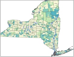
- State counties differ considerably in terms of geography and demographics.
- New York County (Manhattan) spanning 33.8 square miles has over 69,000 people per square mile.
- Hamilton County (1,808 square miles) has fewer than three people per square mile.

Accomplishments:
- New York State Tracking partnered with the National Weather Service and National Aeronautics and Space Administration (NASA) to provide a health-based justification for lowering the heat advisory threshold from 100 to 95 degrees Fahrenheit. The Governor issued a press releaseExternal highlighting the work.
- New York State Tracking calculated census tract-based life expectancy dataExternal for New York State.
Local Resources:
NYS Tracking has developed several resources to help residents prepare for extreme heat events and prevent heat-related illness.
More Information:
Page last reviewed: December 10, 2018
Content source: Centers for Disease Control and Prevention