


At a glance
Human, animal, and vector (e.g., mosquitos) movement contributes to the geographic spread of infectious diseases. The Population Connectivity Across Borders (PopCAB) method enables gathering and analyzing information about population mobility. The collected data can be used to inform public health interventions designed to limit the spread of health threats to new areas. PopCAB assists with identifying the types of travelers moving through an area, the routes taken, and the reasons for travel. Understanding these patterns of movement can help inform preparedness and response strategies to infectious diseases.
Background
Global mobility and cross-border movement contribute to the spread of infectious diseases worldwide. Understanding movement patterns is crucial for informing tailored public health interventions. Public health officials can apply CDC's PopCAB method to visualize population movement patterns and identify areas where they can implement tailored interventions to prevent, detect, and respond to the spread of diseases. For example, the information can guide how to prioritize and allocate resources for outbreak response, including identifying areas where public health surveillance should be strengthened, where vaccination campaigns might be most beneficial, or where other interventions should be implemented.
Goal
The overall goal of implementing PopCAB is to gather, analyze, and apply information about population mobility to inform public health interventions.
Approach
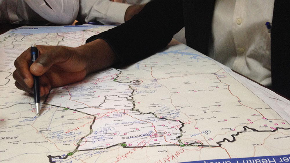
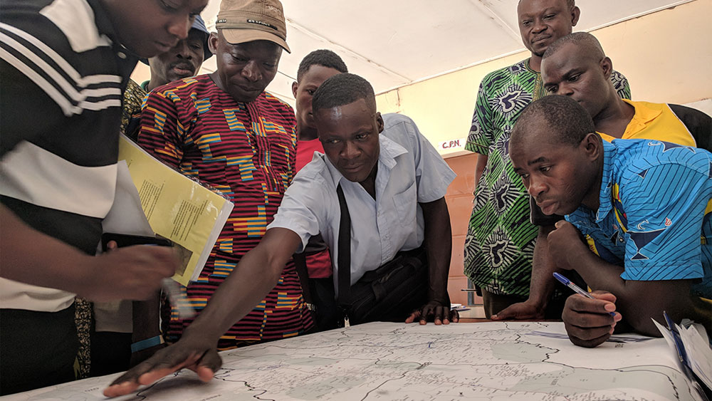
PopCAB is a mixed-methods approach that uses focus group discussions (FGD) and key informant interviews (KII) to gather information about population mobility patterns. Participants use maps to illustrate points of interest and travel routes. The results may be supplemented with quantitative information gathered through surveys of individuals who frequent the points of interest, as well as onsite observation of volume of visitors, public health infrastructure, etc. Public health practitioners can implement PopCAB at the national, subnational, and community levels, including in areas of interest that may be close to an outbreak zone, that may be at or near border crossing points or large gathering points, or along heavily trafficked transportation routes. PopCAB data collection and analysis can be completed within a few days to support outbreak response or over extended periods for longitudinal analyses.
The PopCAB method incorporates a tiered data collection approach that employs qualitative and quantitative methods that build on existing information (Annex 1, Annex 2). The methods are designed to be flexible and adaptable to each project's specific objectives. Based on the user's defined PopCAB objectives, implementers can engage with representatives from economic, health, transportation sectors and more.
Although PopCAB has traditionally been applied to address the health risks associated with human mobility, animal mobility also contributes to the geographic spread of disease. Insects—including vectors, such as ticks or fleas, that may be carried by animals—can also contribute to the geographic spread of disease. To support the One Health approach, a similar method—Zoonotic Connectivity Across Borders (Z-CAB)—can be used to characterize the movement of animals or animal products that may facilitate the spread of zoonotic diseases.
Examples of objectives to address infectious disease spread associated with mobility
- Describe healthcare-seeking behavior
- Map the connectivity of towns to an outbreak-affected area
- Identify best placement for human or animal health screening checkpoints
- Describe resource (e.g., handwashing stations, personal protective equipment) availability at points of interest
- Identify points of interest (e.g., markets, places of worship, abattoirs) for increased risk communication
- Identify high-risk communities for strengthening community-based public health surveillance
- Characterize seasonality of movement
- Identify priority points of entry for public health surveillance
- Identify geographic areas for zoonoses prevention and control interventions
Examples of participant groups to engage
- Healthcare workers
- Traditional healers
- Transportation workers
- Marketplace vendors
- Religious leaders
- Tourists
- Herders
- Veterinarians
- Abattoir workers
Impact
Infectious disease prevention and control efforts are often resource-intensive and can strain the ability of public health systems to respond when outbreaks occur, particularly in lower-income settings. The information and spatial data gathered through PopCAB or Z-CAB activities can enable public health officials to direct scarce resources to the most at-risk populations or geographic areas and to implement tailored interventions, thereby facilitating a more efficient, timely, and cost-effective response.
Implementation
The implementation team can tailor PopCAB or Z-CAB to collect information about the movement patterns and behaviors of specific populations or associated with geographic areas of interest with elevated risk of spread of infectious disease. Public health leadership can consider implementing PopCAB or Z-CAB in areas where the risk of spreading or proximity to an outbreak is high. Other areas of interest for implementation frequently include border areas, heavily trafficked transportation routes, busy markets, or other landmarks that draw large numbers of people from distant locations. The implementation team asks selected participants an array of questions about their own mobility as well as the mobility of others or animals in or passing through their communities. The information gathered can inform public health decisions and evaluate changes in movement and connectivity patterns after response policies have been put into effect.
Public health authorities can request training materials, guidance, and tools to implement PopCAB or Z-CAB by emailing gbht@cdc.gov.
An example for tailoring PopCAB implementation to address disease response
Health authorities have identified long-distance truck drivers as a population of interest in some African countries because these drivers typically cross several international borders along their routes. During an outbreak situation, this movement can create a risk for both international and domestic disease transmission. Focus group discussions with truck drivers may generate valuable information about:
- The routes they take
- Where do they stop and for how long
- The amount of interaction they have with the local community at each stop
- Where they go for emergency medical care during their routes, and
- Factors that could affect which routes they take like road conditions, areas of insecurity, and point-of-entry closures
PopCAB participants can use the information gathered through interviews with truck drivers to identify potential transmission hotspots and develop tailored risk communication campaigns at strategic truck stops. They can also use the information to educate drivers about the risk of transmission, possible symptoms, and what to do if experiencing symptoms.
Annex 1: Data Sources for Migration and Movement
Additional mobility data sources can be used in tandem with PopCAB or Z-CAB data to further understand movement patterns in a specific area. By combining multiple mobility data sources in an analysis, a country or region can achieve a more complete understanding of connectivity patterns within and across its borders. Explore the data sources below for a diverse set of information about mobility patterns worldwide.
Aerial and satellite imagery: Offers an expansive database of high-resolution aerial imagery, elevation data, 3D models and analytics.
Armed Conflict Location and Event Data (ACLED): Provides detailed information to help identify, understand, and track patterns and trends in conflict and crisis situations around the world. It features dates, actors, locations, fatalities, and modalities of reported global political violence and protest events.
Facebook Data for Good: Features information on population density; electrical distribution grid maps; internet access, and more.
Facebook Disaster Maps: Provided insights for crisis response and recovery. Offers aggregate usage patterns of social media apps after a natural disaster.
FAO Gridded Livestock Data: Rasters (gridded matrix data) of global spatial distribution of cattle and other animals.
Flowminder: Resources and tools for using cell phone data to support decision making.
Global Internal Displacement Database: A tool for exploring and visualizing disaster-related displacement risk metrics and for assessing the likelihood of the occurrence of specific displacement events.
Columbia University Libraries GRID 3 – Settlement boundaries: Features settlement extents for select countries in Africa.
Global Data Institute Displacement Tracking Matrix: Gathers and analyzes data to disseminate critical multi layered information on the mobility, vulnerabilities, and needs of displaced and mobile populations.
Uppsala University Conflict Data Program: Source of data on organized violence and is the longest-running active effort dedicated to collecting and maintaining conflict data.
WorldPop: Features open spatial demographic data and research offering data on internal migration flows for selected countries.
Annex 2: Additional Reading Materials
Harvey B, Dalal W, Amin F, McIntyre E, Ward S, Merrill RD, Mohamed A, Hsu C (2020). Planning and implementing a targeted polio vaccination campaign for Somali mobile populations in Northeastern Kenya based on migration and settlement patterns. Ethnicity & Health; 27(4). DOI: 10.1080/13557858.2020.1838455
Kakaï CG, Okunromade O, Dan-Nwafor C, Chabi A, Martial G, Dalhat M, Ward S, Tante O, Nguku P, Hamadi A, Ilori E, Lokossou V, Brito C, Ojo O, Kone I, Agbeko T, Ihekweazu C, Merrill RD (2020) Improving Cross-Border Preparedness and Response: Lessons Learned from 3 Lassa Fever Outbreaks Across Benin, Nigeria, and Togo, 2017-2019. Health Security; 18, S1;S105-S112
Medley AM, Gasanani J, Nyolimati CA, McIntyre E, Ward S, Okuyo B, Kabiito D, Bender C, Jafari Z, LaMorde M, Babigumira PA, Nakiire L, Agwang C, Merrill R, Ndumu D, Doris K. Preventing the cross-border spread of zoonotic diseases: Multisectoral community engagement to characterize animal mobility-Uganda, 2020. Zoonoses Public Health; 68(7):747-759. DOI: 10.1111/zph.12823
Merrill RD, Chabi AIB, McIntyre E, Kouassi J, Alleby M, Codja C, Tante O, Godjedo P, Kone I, Ward S, Agbeko T, Kakaï C. (2021) An approach to integrate population mobility patterns and sociocultural factors in communicable disease preparedness and response. Humanit Soc Sci Commun; 8, 23. DOI: 10.1057/s41599-020-00704-7
Merrill RD, Rogers K, Ward S, Ojo O, Kakaī CG, Agbeko TT, Garba H, MacGurn A, Oppert M, Kone I, Bamsa O, Schneider D, Brown C. (2017) Responding to communicable diseases in internationally mobile populations at points of entry and along porous borders, Nigeria, Benin, Togo. Emerg Infect Dis; Supp 23;13:2250-56.
Nakiire L, Mwanja H, Pillai S, Gasanani J, Ntungire D. Nsabiyumva S, Mafigiri R, Muneza N, Ward S, Daffe Z, Ahabwe P, Kyazze S, Ojwang J, Homsy J, Mclntyre E, Lamorde M, Walwema R, Makumbi I, Muruta A, Merrill RD (2020) Population Movement Patterns Among the Democratic Republic of the Congo, Rwanda, and Uganda During an Outbreak of Ebola Virus Disease: Results from Community Engagement in Two Districts — Uganda, March 2019. MMWR Morb Mortal Wkly Rep;2020 Jan 10;69(1):10-13
Nanziri C, Ario A, Ntono V, Nsereko G, Monje F, Aliddeki D, Bainomugisha K, Bulage L, Kadobera D, Kyazze S, Kayiwa J, Tusiime P, Mabumba E, Makumbi I, Nakiire L, Walwema R, Lomarde M, Ocom F, Kasule J, Ward S, Merrill RD. Ebola Virus Disease Preparedness Assessment and Risk Mapping in Uganda, August – September 2018. Health Secur Mar/Apr 2020;18(2):105-113. DOI: 10.1089/hs.2019.0118.
This page was last updated on this date. Updates may include minor edits, image changes, or other modifications to page content.
The information on this page was last reviewed by subject matter experts to ensure accuracy.