Skip directly to search Skip directly to A to Z list Skip directly to site content
CDC Home

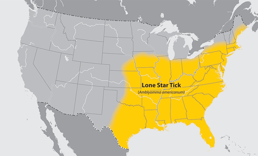
Approximate Distribution of the Lone Star Tick

Approximate distribution of the Lone Star tick

About This Map

This map is not meant to represent risks for a specific tick-borne disease, because disease transmission is influenced by multiple factors beyond mere tick presence. This map has been designed to answer the question "What ticks should I be concerned about at a regional scale?" Please consult a local public health authority or USDA Agricultural Extension Office to determine more specific information at the state, county, or municipal level. Background data for this map is from the US National Atlas.

Download this map [PDF - 2 pages]

 
USA.gov: The U.S. Government's Official Web PortalDepartment of Health and Human Services
Centers for Disease Control and Prevention   1600 Clifton Road Atlanta, GA 30329-4027, USA
800-CDC-INFO (800-232-4636) TTY: (888) 232-6348 - Contact CDC–INFO
A-Z Index
  1. A
  2. B
  3. C
  4. D
  5. E
  6. F
  7. G
  8. H
  9. I
  10. J
  11. K
  12. L
  13. M
  14. N
  15. O
  16. P
  17. Q
  18. R
  19. S
  20. T
  21. U
  22. V
  23. W
  24. X
  25. Y
  26. Z
  27. #