Map Details – Food Deserts in Texas
Impact Statement
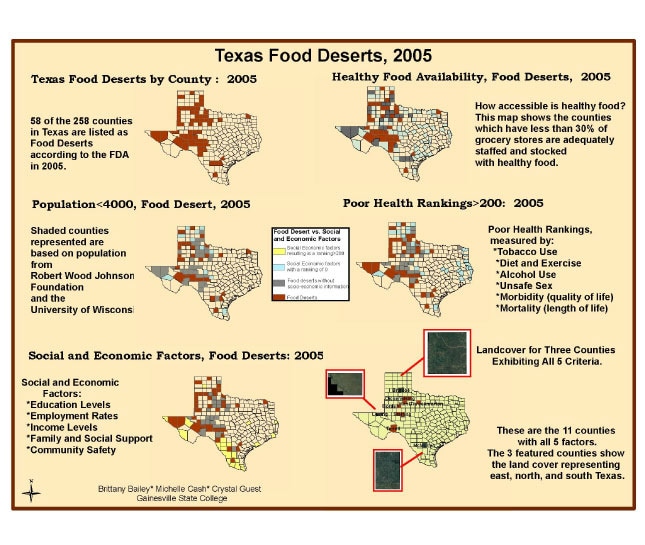
Of Texas’ 258 counties, 58 counties are considered Food Deserts according to the USDA definition and criteria. The criteria include lack of availability of fresh produce and limited or no presence of large grocery stores (stores with four or more employees). The areas identified as Food Deserts were further analyzed based on health rankings, population below 4,000, and socio-economic rankings. Counties were displayed in subsequent maps based on negative impact of the examined social criteria and their position as a Food Desert. Finally, counties that exhibited negative social impact based on all examined categories and designated as Food Deserts were identified.
There are several areas within the United States that meet the USDA criteria and have been identified as Food Deserts. Texas was chosen for analysis based on its large area, varied topography, representation of a full spectrum of income levels and diverse ethnic presence. Further analysis is warranted to determine the impact of available public transportation, fast food chains, ethnic pockets, land use and hydrological analysis, and climate and weather patterns before making any meaningful assessments and conclusions.