GISVaxView

Welcome to GISVaxView! New
GISVaxView (geographic information system) is the site for mapping geospatial vaccination related data across the lifespan.
The purpose of this system is to provide jurisdictions and other partners geospatial data and tools to inform planning, implementation, and evaluation of vaccine activities and outcomes. The system allows visitors to better understand the local-level indicators that contribute to vaccine confidence and coverage, visualize data for populations at increased risk, identify community resources and barriers, and connect community stakeholders. This system was designed based on feedback from CDC stakeholders along with health planners and data analysts from several local health departments.
The Vaccine Activity Planner application includes COVID-19, Flu, and RSV vaccination data for adults from the National Immunization Survey Adult COVID Module (NIS-ACM) and is built upon CDC’s COVID-19 Vaccination Mapping Tool which will be discontinued in April 2024. This complements CDC’s respiratory virus season weekly vaccination dashboards RespVaxView. Please see data notes for more information.
Planned enhancements include addition of COVID-19, Flu, and RSV vaccine data from NIS-ACM for select U.S. territories and sub-state jurisdictions, NIS vaccination data for children and adolescents, and geospatial data for other vaccines, and vaccine data from other data sources, as available and feasible. Feedback and partners’ needs will inform addition of other data sources and additional GIS applications.
Your input and feedback for how to make this more useful are welcome – please email us.
GISVaxView Interactive!
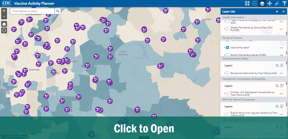
Vaccine Activity Planner
View available weekly COVID-19, flu, and RSV vaccine coverage data using interactive maps, trend lines, bar charts, and tables.
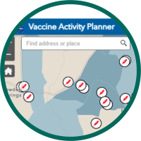
STEP 1
Search for your area.
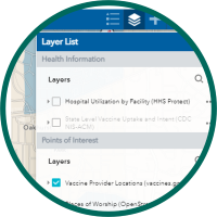
STEP 2
Explore layer list.
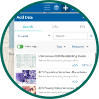
STEP 3
Add data from ESRI Living Atlas.
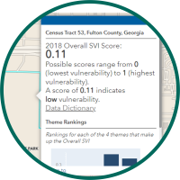
STEP 4
Select, Filter, and Analyze.

Monitoring coverage for recommended vaccinations across the country helps CDC assess how well local areas, states, and the nation are protected from vaccine-preventable diseases. Find vaccination coverage data for all ages at: