Mining Contract: Application testing of thermal imaging cameras for the detection of rockfall events and conditions in open pit mines
| Contract # | 75D30120C09871 |
|---|---|
| Start Date | 9/15/2020 |
| End Date | 8/31/2022 |
| Research Concept |
Rockfall events are frequent hazards in open pit mine environments and present a major risk for fatalities and injury to mining personnel. Using thermal imaging cameras is a proven technology that has been in service for a wide variety of uses—from detecting mechanical or structural faults to identifying footprints of humans in a burning building. Thermal sensors can detect small differences in heat, down to as little as 0.01°C, and can operate in both lighted and dark conditions. This technology has been evaluated for geotechnical purposes in studies that have shown thermal imaging cameras can detect rockfall events and recognize hazards; however, there have been no studies that have focused on testing different models and placements of these cameras for systematically detecting rockfall in open pit mining operations. The objective of the work is to test the effectiveness of thermal imaging cameras to detect and record rockfall events and rockfall hazards in surface mining operations as a method to protect mine workers from the risks of rockfalls. |
Contract Status & Impact
This contract is complete. To receive a copy of the final report, send a request to mining@cdc.gov.
This contract aimed to evaluate the potential for thermal imagery for use in automated early detection of slope failure in open pit mines. To best mitigate risk to workers and operations, an ideal automated rockfall monitoring system would not only report the rockfall when it occurs but also alert workers to potential rockfall hazards. This ideal system would provide coverage in all weather and temperature ranges regardless of lighting conditions. The contracted work evaluated the capability and limitations of several thermal surveillance cameras in detecting rockfall hazards and events for open pit mines. Cameras were evaluated in a variety of settings and conditions to enable the creation of better tools for monitoring and mitigating the risk of rockfall to mining personnel.
The current state of thermal imaging cameras is mature and robust for various government and industry applications. However, the application of this technology for detecting rockfall events and hazards in the mining industry is still in the early stages despite the apparent interest from the industry. Possible reasons why this technology hasn’t been adopted would be the low resolution of earlier sensors, durability, and price. Presently, it is evident that this technology has expanded beyond military and experimental research applications.
This study focused in part on acquiring equipment and developing a mobile monitoring platform (MMP) (Figure 1). Data collection at seven different mines in all weather conditions and seasons was conducted, representing different geological conditions ranging from mid-summer heat and monsoon rains in Arizona to the depth of winter in the Rocky Mountains of British Columbia. Findings support the concept that thermal imaging has significant potential for use as an early warning system for large-scale slope failure. For example, Figure 2 shows the cumulative rockfall frequency versus time before a large slope failure at a test mine site. This relationship showing an increase in rockfalls before failure may be useful as a predictive tool similar to inverse velocity plots on other slope monitoring systems such as radar.
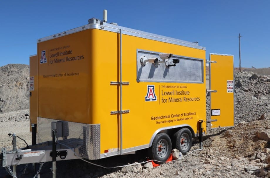
Figure 1. The Mobile Monitoring Platform (MMP) developed for deployment at test mine sites.
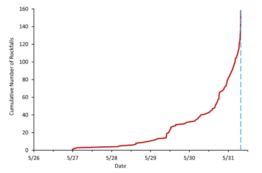
Figure 2. Cumulative number of rockfalls versus time preceding a large slope failure event.
Additionally, the cameras observed frictional heating of a landslide surface for the slope failure that occurred on May 31st. Temperatures observed before slope failure ranged from 57°F to 74°F (14°C to 23°C). An elevated temperature was observed on the landslide surface of 112 F (45°C) along the basal shear plane, starting approximately 15 seconds after the release of the main landslide (Figure 3). This may be the first remotely sensed observation of the basal plane frictional heating due to a landslide.
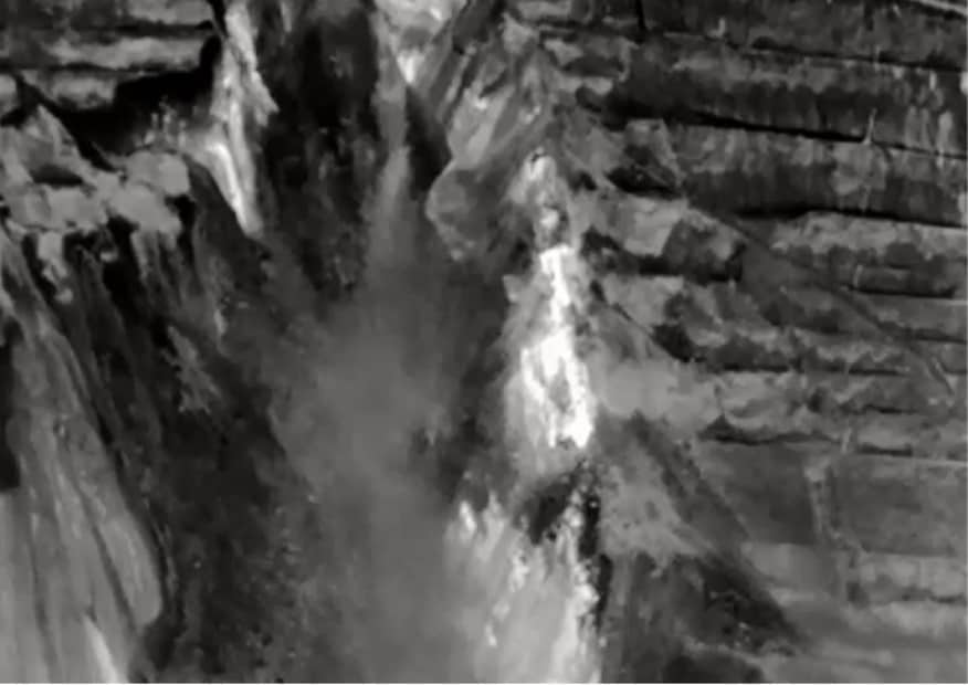
Figure 3. Thermal image reflecting elevated temperatures along the basal shear plane of a large-scale slope failure.
Logic was developed for automating the identification of rockfall events in the recorded video. The University of Arizona research computing assisted the Geotechnical Center of Excellence in developing a computer algorithm and code in Python to identify rockfall events from thermal video recordings. This process includes background video segmentation, detecting blobs or objects, assigning a centroid, and recording the track. An outline or process is being developed to scale this algorithm to run in real-time.
Below is a list of published research generated from this research:
Schafer, K.W., Wellman, E.C., Noonan, G.E., Ross, B.J., Williams, C.P, Bakken, K., Abrahams, G. & Hicks D. (2022) Thermal Imaging Analysis of Rockfalls Leading to Slope Failures at an Open-Pit Mine. Slope Stability 2022 Conference, Tucson SS2022-104.
Wellman, E.C., Schafer, K.F., Williams, C.P. & Ross, B.J. (2022). Thermal Imaging for Rockfall Detection. American Rock Mechanics Association, Annual Meeting, Santa Fe. ARMA 22-430.
Prescott, B., Wellman, E.C., Ross, B.J., Davidson, J., Nielsen, R. (2022). Comparison of Doppler Radar to Thermal Infrared Rockfall Detection. Slope Stability 2022 Conference, Tucson SS2022-200.
Wellman, E.C., Schafer, K.W., Prescott, B, Williams, C.P., Ross, B.J. (2022) Findings from the Thermal Imaging for Rockfall Detection Project. Slope Stability 2022 Conference, Tucson SS2022-032.