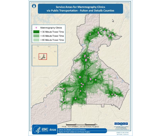
Map Details – Service Areas for Mammography Clinics via Public Transportation, Georgia Counties
Impact Statement
This project constructed and used a geographic information system and network analysis to quantify spatial and temporal accessibility to mammography facilities in the Atlanta metropolitan area. This map shows the areas around each mammography facility that can be reached via public transportation in less than 45 minutes, less than 60 minutes, and less than 90 minutes travel time.