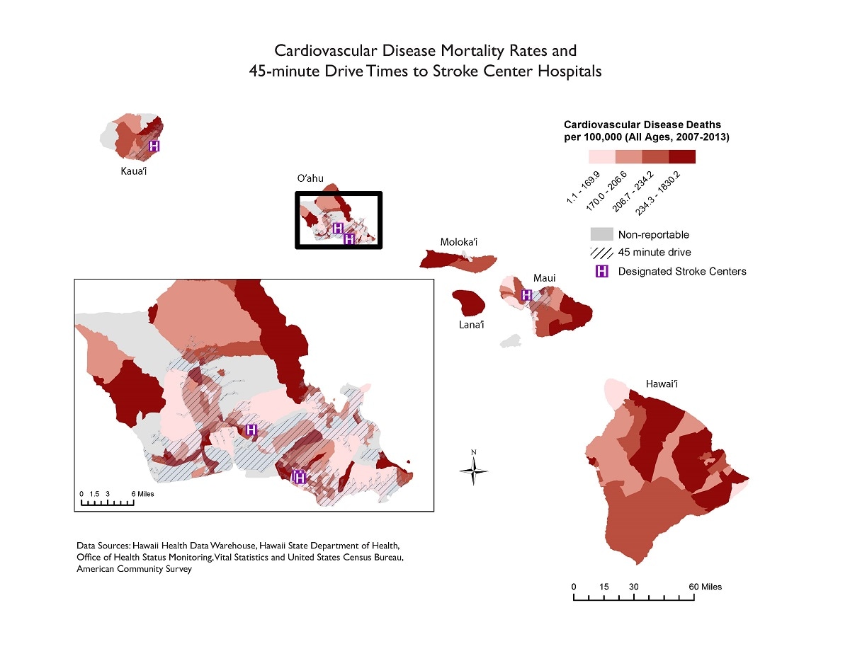
Map Details: Cardiovascular Disease Mortality Rates and 45-minute Drive Times to Stroke Center Hospitals
Impact Statement
This map examines cardiovascular disease mortality rates by census tract and identifies locations of designated primary and comprehensive stroke centers.

Key Points
Major Findings
Several census tracts in the highest quartile of cardiovascular disease mortality rates are located on islands (Hawaii [Big Island], Moloka‘i, and Lana‘i) with no access to a stroke center. Even on O‘ahu, with three designated stroke centers, there are several census tracts with high mortality rates that fall outside the 45-minute drive time range.
How the map will be used, or has been used
This map will be useful to identify areas that are lacking resources to properly treat persons who have had a stroke.