TOOLS AND TECHNIQUES
Use of BRFSS Data and GIS
Technology for Rapid Public Health Response During Natural Disasters
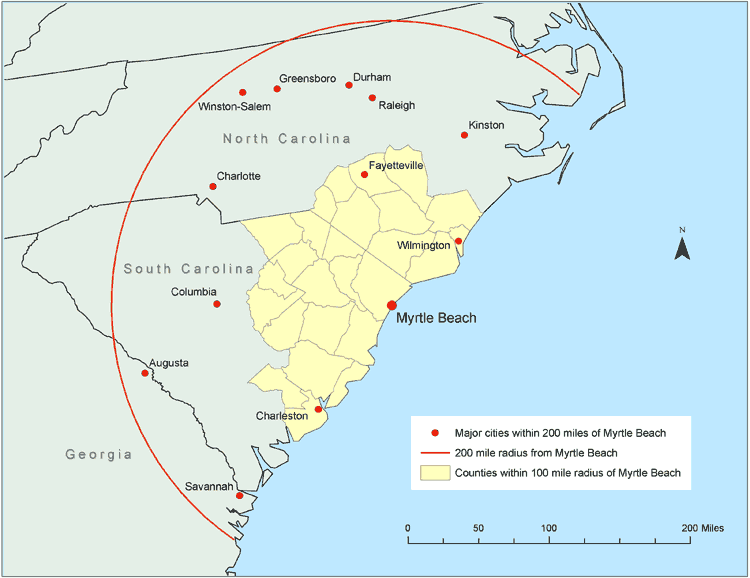
Figure 2. Counties with population-weighted centroids within a 100-mile radius and major cities within a 200-mile radius of Myrtle Beach, South Carolina, 2000. Data from U.S. Census Bureau (12).
![]()
Volume 5: No. 3, July 2008