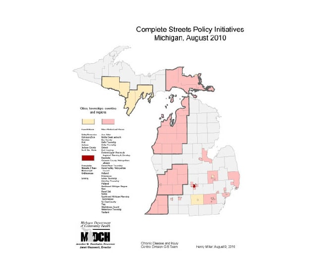
Map Details – Complete Streets Policy Initiatives Michigan
Impact Statement
This map displays three levels of policy—resolutions, ordinances, and non-motorized plans—by four types of jurisdictions, including cities, townships, counties, and regions. The map documents areas with and without policy initiatives and shows the reach of the Complete Streets project.